What we consider Zones?
Zones in Perspio represent defined geographic areas, typically regions such as states or territories, that are used for geofencing, reporting, and triggering alerts. As of now, we have Zones aligned with states and territories within Australia and United States.
These zones help categorise and monitor asset activity, events, or alerts within specified geographic boundaries, supporting better visibility and operational control.
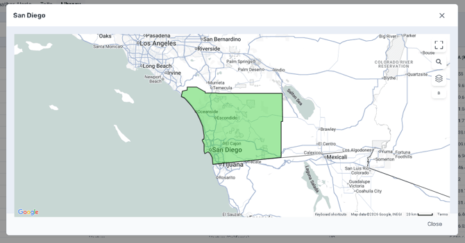
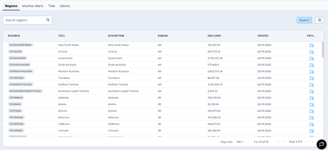
Regions Tab
This tab lists defined geographic zones with detailed information for each:
-
ID – Internal identifier for the zone.
-
Title – Name of the region as displayed across the system.
-
Description – Additional details or alternative naming for the zone.
-
Type – Specifies the zone category (e.g., RegionGeofence).
-
Domain – The domain or country code the zone belongs to (e.g., AU, US).
-
Created Date – Date the zone was first created.
-
Updated Date – Last date the zone was modified.
-
Is Active – Indicates whether the zone is currently active and available for use.
Use the Search bar to quickly locate specific zones. The Export button lets you download the complete list for review or record-keeping.
Weather Alerts Tab
Lists zones specifically configured for weather-related alerts. These zones help ensure proactive monitoring and timely responses to severe weather conditions that might affect assets, routes, or operations. Each weather alert zone includes:
-
ID – Internal identifier for the weather zone.
-
Name and Description – Clearly outlines the weather condition triggering the alert.
-
Type – Typically "WeatherGeofence".
-
Domain – Geographic or organisational domain.
-
Is Active – Shows if the alert zone is currently active.
Use the Search bar to quickly locate specific zones. The Export button lets you download the complete list for review or record-keeping.
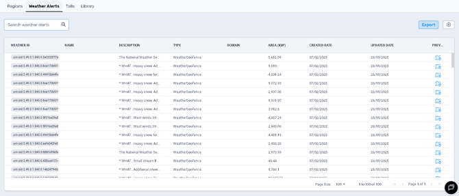
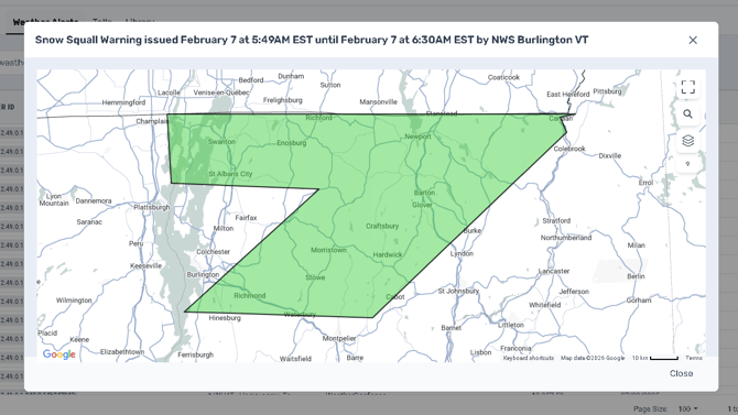
Click on Preview Icon to open the Map and visualise the Alert Area:
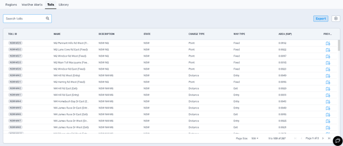
Tolls Tab
Provides a detailed list of toll road segments integrated into Perspio, assisting in accurate tracking and cost allocation for toll-related charges. These charges can then be written to a contract when ERP Integrations are turned on. Each entry specifies:
-
ID – Identifier for the toll segment.
-
Name and Description – Specific details of the toll road segment.
-
Toll Road State – State or region the toll road is located in.
-
Toll Charge Type – Method of toll calculation (e.g., Point or Distance-based).
-
Master Data Type – Generally marked as "TollRoads".
Use the Search bar to quickly locate specific zones. The Export button lets you download the complete list for review or record-keeping.
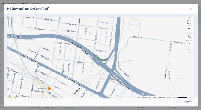
Click on Preview Icon to open the Map and visualise the Toll Area:
Library Tab
Provides a detailed list of specific Geofences, registered to be used in Perspio. Only some US Counties at the moment.
-
ID – Identifier for the Geofence.
-
Name and Description – Specific details of the Geofence.
-
Domain – State or region the toll road is located in.
-
Area – Method of toll calculation (e.g., Point or Distance-based).
Use the Search bar to quickly locate specific zones. The Export button lets you download the complete list for review or record-keeping.
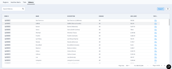
Click on Preview Icon to open the Map and visualise the Area: